The choice to make the Rogue Valley of southern Oregon our first major [an error occurred while processing this directive] stop turned out to be a wonderful decision. The summer months had perfect weather and the scenery was breathtaking.

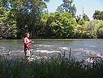
Charlie fishing in the Rogue River. “I thoroughly enjoyed wading in the Rogue, but would love to actually catch a trout, one of these days.”
In February of 2005 my wife and I arrived in Ashland, the eastern-most city of the valley. Our plan was to stay in the Rogue Valley six to nine months, then move on before next winter. Even well made plans change over time, and ours was extended to a full year due to the birth of our first child.
One of the many reasons we enjoy traveling by RV is the ability to stay in one place for an extended period and get to know the area better than a typical tourist hitting only the highlights. Having spent a full year in the Rogue Valley permitted us to see many sights and make new friends. In this article, I would like to share with you the more memorable sights we have visited in and near the valley.
About the Rogue Valley
Taking its name from the Rogue River, the valley lies in the southwest corner of Oregon, running in a diagonal direction between Ashland and Grants Pass. Between the two cities lie several others, the largest being Medford in the center of the valley. If one were to drive from Ashland heading north on Interstate 5, the following cities would be crossed: Talent, Phoenix, Medford, Central Point, Gold Hill, Rock Point, the city of Rogue River, and Grants Pass.
Weather was an important consideration for choosing this destination. Unlike further up the coast, the Rogue Valley receives much less rain, especially in the summer. In the winter the valley does receive a good amount of rain, and 2005 was no exception. Most days it rained at least a small amount well into March. As summer approached, the sunny days increased in frequency. Between mid-April and mid-October, the summer was absolutely beautiful with warm, dry days; perhaps a couple of rainy days all summer long.
In July the days got hot, some as high as 105°. The difference between a 105° day in the valley and a similarly hot day in Dallas, Texas, was obvious—in the valley one could stand in the shade and feel comfortable, whereas in Dallas the shade seems to make little difference. After sunset in the Rogue Valley, the temperature dropped quickly, usually dipping down to the low 70’s during the night.

The cool, clear waters of the Rogue River start on Mt. Mazama near Crater Lake. The river offers excellent fishing and water activities throughout the valley.
According to the locals, the winter of 2005/2006 was an unusually wet one, even for southern Oregon. This was great news for the ski slopes, but soggy for the rest of us. Apparently once every 10-15 years the winter is so wet that rain falls continuously for days.
Mid-October brought rain with increasing frequency. Precipitation throughout winter was nearly a daily event, up until we left in early February of 2006. Most days had light drizzle for several hours, with breaks long enough to walk the dog without getting soaked. There were also an abundant number of days when the rain fell without ceasing. The worst stretches were two different weeks during which we cannot recall a span of time without precipitation. On such days we had no choice but to don our rain gear and get soaked while walking the dog. Indeed, the rainy winter wore on us. After three and a half months of wet, we were ready for a dryer climate.
Ashland
The town of Ashland was our first exposure to Oregon. It is a beautiful town set in the foothills of Mt. Ashland at an average elevation of 1,800 feet. The downtown is quaint and well kept. It is host to Southern Oregon University, whose students and campus locations are an integral part of town. Ashland is best known for the Shakespeare Festival, with productions running eight months out of the year.

Downtown Ashland with a hillside neighborhood in the background.
The gentleman at the visitor information desk proudly informed us that there is not one chain restaurant in the Ashland downtown area. With the exception of a Starbucks, he was certainly correct. This means that dining in Ashland is always a unique experience, with restaurants ranging from the very casual to the formal. Shopping is also plentiful in a variety of unique stores, many of them featuring works by regional artisans.
Adjacent to central downtown is Lithia Park—a scenic place to walk, jog, or sit on the benches to enjoy the lush landscape. Through the park runs Ashland Creek, fed primarily by melting snow and rain from Mt. Ashland. In the summer, the creek runs clean and swift over mossy boulders. Living up to its name, Lithia Park features a drinking fountain fed by naturally carbonated water. Having grown up in Romania with an abundant variety of mineral waters, I enjoyed drinking this lithia water. I must say, though, that most people would find the heavy sulfur content putrid. After hearing how much I enjoyed drinking it, my brother-in-law took a deep swallow, only to spit it back out.

Lithia Park clothed in autumn colors, adjacent to downtown Ashland.
A short 15 miles away is Mt. Ashland, reaching an elevation of 7,533 feet. In winter, it is a snow sports playground with ski slopes for beginners and experts. In summer, it is open to hikers and mountain bikers.
In late June we drove our scooter up to the ski resort for a short hike. From the parking lot the summit is accessible on foot by those in reasonably good shape. On a clear day one can look south from the parking lot to see Mt. Shasta’s white cap in northern California. By early June the snow was gone from Mt. Ashland, with the exception of a few patches on north-facing slopes. In the valley it was around 90°; on the mountain about 50°—perfect temperature for hiking.
For a scenic drive, especially in winter when the hills and mountains are snowcapped, take highway 66 out of Ashland heading east. Shortly after crossing over I-5, turn left onto Dead Indian Memorial Road and take it as far as you like into the countryside. Soon the road winds its way to higher elevations. Several wide shoulders make it possible to pull over and enjoy the scenery. At one such stop there is a wonderful view of Mt. Ashland.
Also on highway 66, a few miles past Dead Indian Memorial Road, is Emigrant Lake. This is a smaller lake with stone shores, but large enough for speed boats and other water activities. There is a $3 day use fee per vehicle. In spring, the RV section of the park opens. We drove through the RV section in our truck, and it seems that the slots are suitable for smaller RV’s only, perhaps those under 30 feet.
Phoenix

A vineyard bathed in the orange glow of the setting sun on the outskirts of Phoenix, Oregon.
Exit 24 on Interstate 5 takes you into Phoenix, home to numerous pear orchards and vineyards on the outskirts of town. In early spring the pear trees are veiled in blossoms white as snow.
For a scenic ride in the spring through fall, especially on a motorcycle, take exit 24 on I-5 and drive east on Fern Valley Road until it dead ends into Payne Road. Turn right, or south, and you will be surrounded by orchards, hills, and ranches. Continue on to Suncrest Road and make a left turn, heading east. Follow this winding road until it turns into Valley View Road, which takes you all the way to Ashland.
While in the area, visit Paschal Winery & Vineyard for wine tasting. You can find them at 1122 Suncrest Road, overlooking pear orchards and having the Siskiyou mountain range for a backdrop.
Medford
The largest town in the valley, Medford has a little bit of metropolitan feel. Compared to large cities like Dallas, we consider Medford a small to medium size city. Traffic can get a little slow for a short time during rush hour, but after experiencing gridlock in places like Los Angeles, Medford’s traffic problems seem non-existent.
The town offers a mall, several shopping centers, a Cinemark theater, most of the major retailers, and an international airport. A noteworthy retailer is Harry & David, known for their Oregon pears. To get there, take exit 27 from I-5 and go west to the first traffic signal, then turn left onto E. Steward Avenue and left again on Center Drive—Harry & David is on the right side.

Standing atop Roxy Ann Mountain, Medford and the surrounding valley are visible for miles.
A familiar backdrop to Medford is Roxy Ann Mountain on the east side of town. Hikers can drive the dirt road about half way up the mountain and park, then walk to the 3,500 foot peak. Horses and dogs are welcome on the trails. A panoramic view of Medford and surrounding mountains await you on the summit. Mt. McLoughlin is visible on clear days to the east, about thirty miles away. To the west, the two Table Rock mountains are also visible with their distinctive flat tops.
Roxy Ann is accessible from town via Hillcrest Road. As you turn east onto Hillcrest from North Phoenix Road, on your left is Hillcrest Orchard and RoxyAnn Winery—another opportunity for wine and pear tasting. Even if you have no interest in hiking, do drive out toward Roxy Ann to view the beautiful houses along the foot of the mountain.
Central Point

Lower Table Rock, with its flat top, is the most distinguishing feature near Central Point.
Another geological feature in the Medford area are the two Table Rock mountains, formed by two sections of lava flows remaining after the rest eroded away. Lower Table Rock’s flat top is distinctly visible from I-5 while driving past the town of Central Point.
Hikers can take Table Rock Road from Medford or Central Point, then follow the signs to Lower Table Rock. The easy-to-moderate trail takes hikers from the parking lot up about 700 feet to the expansive mountain top. In spring, the flat, rocky terrain blooms with mostly yellow flowers, providing ample opportunities for pictures. On top, the foot trail continues from the center section of the mountain to the sheer cliffs on the south side, overlooking I-5, Central Point, and Medford.
Gold Hill
We spent July through December in the Gold N Hill KOA park in Gold Hill, population 1,000. This rural setting was very enjoyable because we love to walk, jog, and see the river.

Inflatable kayaks, called “Tahitis”, are put it near the main bridge leading into Gold Hill.
From our slot in the campsite, the following were within walking distance: the Rogue River at 0.5 miles, downtown Gold Hill about 1 mile, and Ray’s grocery store about 1.2 miles.
Gold Hill is a very small town and lacks major retail outlets, except for Ray’s grocery store. Other shopping consists of a convenience store, a gas station without diesel, four local restaurants, a pharmacy, two bars, a hardware store, a single-chair barber shop, a beauty shop, a dog groomer, public library, and the U. S. Post Office.
The Tahiti Hut kayak rental opens in the summer on the eastern bank of the Rogue River, just down-stream from the main bridge leading into town. For $25 per inflatable kayak (which they call a Tahiti) you can float this gentle section of the Rogue over class one and two rapids. The float ends in the Valley of the Rogue State Park, from where transportation back to Gold Hill is by van. If you enjoy frigid water against your skin, consider renting a sand bag. Sand bags are large mesh bags filled with packing peanuts, on which a person floats down the river with the aid of kayak oars.
Our favorite walking and jogging route was the Upper River Road along the east bank of the river, starting at Blackwell Road, which is also highway 99. The road runs paved for about two and a half miles north of 99. It has no sidewalk, but we found the shoulder facing traffic acceptable, with only a few vehicles passing by in the evenings.

Delicious blackberries along the Upper River Road in Gold Hill.
To see sights that most tourists miss, take this same Upper River Road about a mile and a half north from 99 to the wide gravel shoulder on the west side of the road, next to the river. Park your vehicle and get out for a nice view of class three and four rapids. In the summer, rafters will be running these rapids and passing within a few yards from the river banks, so have your camera ready. At this same location between July and late September are large quantities of ripe blackberries—delicious fresh or baked in cobbler.
If you don’t mind a bumpy, and sometimes very narrow road, continue on Upper River Road further as it turns into a dirt road. At some point this road becomes Gold Ray Road, but there are no signs indicating this until you come out the other end. The road veers away from the river and leads through a hilly area for a couple of miles, then swings back to follow the river. When the river becomes visible once more, find a wide spot along the road to park your car for a picnic along the river.

A dam on the Rogue River near Gold Hill.
After the picnic, continue further on this dirt road. Soon the road narrows to the width of a single lane. On busy summer days, vehicles may be approaching from the other direction, forcing one of you to pull over while the other passes. By this time the dam should be visible. At the dam the road is paved once more and the shoulder has several wide spots to park. In the fall, when the salmon are running upstream, find a nice rock to sit on and watch the salmon ladder on the other side of the dam for jumping fish. Many salmon first attempt to jump the dam directly. If you are surefooted, crawl down the large boulders to the edge of the water in front of the dam for a close-up look of tired salmon, trying to figure out how to overcome this obstacle. A note of caution: Some of the large rocks near the edge are wet from the spray and can be very slippery. I know this because I slipped and came to rest sitting waste deep in the river.
Waterfalls

From the Rogue Valley, several waterfalls can be visited in an afternoon.
Mill Creek Falls
The closest are the Mill Creek Falls near the town of Prospect. From Medford, take the very scenic highway 62 and drive about an hour. Before reaching Prospect, look for the brown signs along the highway pointing to Mill Creek Falls.
In this location there are two waterfalls, both of them with plenty of water, even in late summer. One waterfall is named Mill Creek and the other Barr Creek. An easy trail leads from the parking lot to a steep, rocky bank opposite the falls. Cedars, madrones, and other local trees complete the lush scenery.
After viewing the falls, backtrack on the trail about half way until you see signs for Avenue of the Giant Boulders. Follow the trail to the large boulders rounded by the Rogue River. The water here is swift, deep, and postcard perfect. Shallow pools along the edge provide a wonderful cool retreat. Braver souls can pose atop large boulders for memorable pictures. In autumn, the turning leaves add even more vibrant colors to this rocky river scene.
Tokatee Falls
About two hours from Medford is Tokatee Falls, the most scenic of the waterfalls we have visited. The quickest way to get there is to take I-5 north to 138 and go east toward the town of Tokatee Falls. Continue east on 138 approximately 3 additional miles to Forest Road 34 and follow the signs to the falls.

This waterfall is on the North Umpqua River, consisting of two sections: an upper section 40 feet high and a lower section 80 feet high. The water above and below the waterfall is a deep turquoise or blue, depending on the angle. It is too steep to walk down to the base of the waterfall, though obvious foot trails exist from people trying. The main viewing area is a large wood deck at the end of a half mile trail from the parking lot.
Watson Falls
About three miles from Tokatee Falls is Watson Falls, the tallest in southwest Oregon at 272 feet. It drops over a vertical stone cliff into a pool surrounded by mossy boulders and lush vegetation.
From Tokatee Falls get back on 138 heading east. After driving less than three miles, turn right, or south, onto Forest Road 37. Almost immediately after turning onto 37, signs for Watson Falls and the trailhead parking lot are visible on the right.
The short trail to the waterfall starts in the parking lot, crosses over the road, and continues in the woods. It meanders through the woods and crosses Watson Creek over a wooden bridge, from which the waterfall is visible. The trail continues closer, ending at a lookout elevated about a third way up the waterfall. My wife and I left the trail at a sharp turn directly in front of the waterfall, and braved the wet boulders to reach the base. There we stood among moss-covered boulders, enjoying the mist on our face.
South Umpqua Falls
Viewing the falls was enjoyable, but we could not consider our experience complete until we swam in one. Up to this point the falls were either physically inaccessible or the water was too swift, or too cold, to enter. My wife inquired about waterfalls in which we could swim, and a co-worker told her about South Umpqua Falls near the town of Tiller.

South Umpqua Falls in late July is a popular place to cool off. Less crowded swimming holes are only a short distance downstream.
To get there, take highway 62 to the town of Trail, then turn north on highway 227, which takes you all the way to Tiller. Before entering town, the highway crosses over the South Umpqua River. After crossing the bridge, take the immediate right on road 46. The waterfall is several miles up this road, just a little past the point when you think you are lost. The park is clearly marked and has a good number of parking spaces. On busy summer days, parking may only be available on the road shoulder.
The waterfall is only about ten feet tall as it gently runs over rounded rock. Enthusiastic kids of all ages slide down the slippery rock of the waterfall into the deep pool below. Others dive or jump from the salmon ladder wall. Outside the pool, the water is shallow and perfect temperature for a refreshing late-July swim.
This section of the river runs over a wide slab of rock, the water only about two inches deep. We spent our time soaking up the sun and the cool water a short distance downstream, where the river is narrower and deeper, some places up to our neck.
Crater Lake
Holding the record for deepest lake in the United Sates at 1,943 feet, Crater Lake is a must see when in southern Oregon. Park staff labor four months to clear winter snow from the rim, and by the first of June the park is open to visitors.

Panorama of Crater Lake as seen from Garfield Peak
Filling the collapsed volcanic crater of Mount Mazama, the deep blue surface of Crater Lake is at 6,174 feet of elevation, a thousand feet below the rim. On a calm day, the smooth lake reflects the surrounding peaks and sky with a nearly perfect mirror image.
Our first visit to the lake was on June 6-th. A good amount of snow remained, especially on north-facing slopes. The parking lot, lodge, and lookouts are all above 7,000 feet of elevation, making a light jacket required even in summer.

Snow is plentiful in June on this north-facing slope of the crater, just below the lodge.
From the Medford area, the lake is about a two hour drive away, accessible by highway 62, then following signs to the park. Shortly after entering the park gates, look for the information center on the left. Many people, eager to get to the rim and see the lake, pass up a visit to the information center. We recommend that you stop and sit through the twenty minute video that explains the formation of the lake and the fascinating process of snow removal—well worth the time.
At the rim the main attraction is the lake. We spent hours looking at it from many angles and taking pictures. Along the parking lot and behind the lodge are walled lookouts, but visitors are free to walk further to unimproved sections of the rim. If you do this, use extreme caution because the slopes are very steep and there are no safety devices whatsoever—one slip and you won’t stop for a thousand feet.

This narrow section of the trail leading up to Garfield Peak has a nearly vertical drop-off on the lake side.
To see a unique perspective of the lake, consider taking the hiking trail past the lodge to the nearby Garfield Peak, standing at 8,054 feet. I suggest allowing three hours for the round trip. My brother-in-law and I had underestimated the distance to the peak and told our family we will be back in twenty minutes. Once we realized that the trail was much longer, we were almost running to make the round trip in an hour and half. The trail starts out easy to moderate, then becomes steeper toward the top; nothing too strenuous that an average adult in reasonable physical condition could not handle. The trail has several narrow passes flanked by almost vertical drops, so those afraid of heights should pass on this one.
A Wonderful Place to Visit
In addition to the places I have mentioned in this article, we have seen many other sights in and near the Rogue Valley, including several day trips to the Pacific coast. Most natural places in Oregon are pristine; suitable for the best outdoors, fishing, or travel magazine cover.

Pacific coastline near Brookings in southern Oregon, about a three hour drive from the Rogue Valley.
In summary, the valley offers the following in the summer: gorgeous, sunny days with comfortable evenings; mountains of every size; lush forests; cool, clear streams and rivers filled with trout; Crater Lake nearby; rugged ocean coast, close enough for day trips; proximity to the redwoods of northern California; waterfalls; kayaking and rafting; and plenty of quaint little towns for shopping and dining.
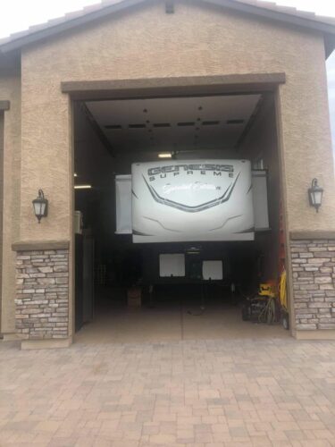
Access to most destinations is available by RV. The valley welcomes and caters to recreational vehicles; it is host to several RV dealerships and numerous year-round RV parks.
You like the outdoors? We think you will love southern Oregon’s Rogue Valley!
Original founder and writer for Changin' Gears. Former full-time RVer!